World crises on one calm map, each linked to its source
GeoForecast is a free live dashboard of conflict, disease, disasters, severe weather and outages, built from 21 public data feeds. Every item links to its source. No account.
For curious readers, and for analysts, journalists, NGO and government teams who check where a number came from.
Read live from public sources
- USGS
- GDACS
- NASA EONET
- WMO
- US National Weather Service
- WHO
- CDC
- UCDP
- ACLED
- ACAPS
- GDELT
- IODA
- FAA
- EASA
- NASA FIRMS
- FRED
- IMF
- World Bank
- ReliefWeb
- Polymarket
Three ways to start
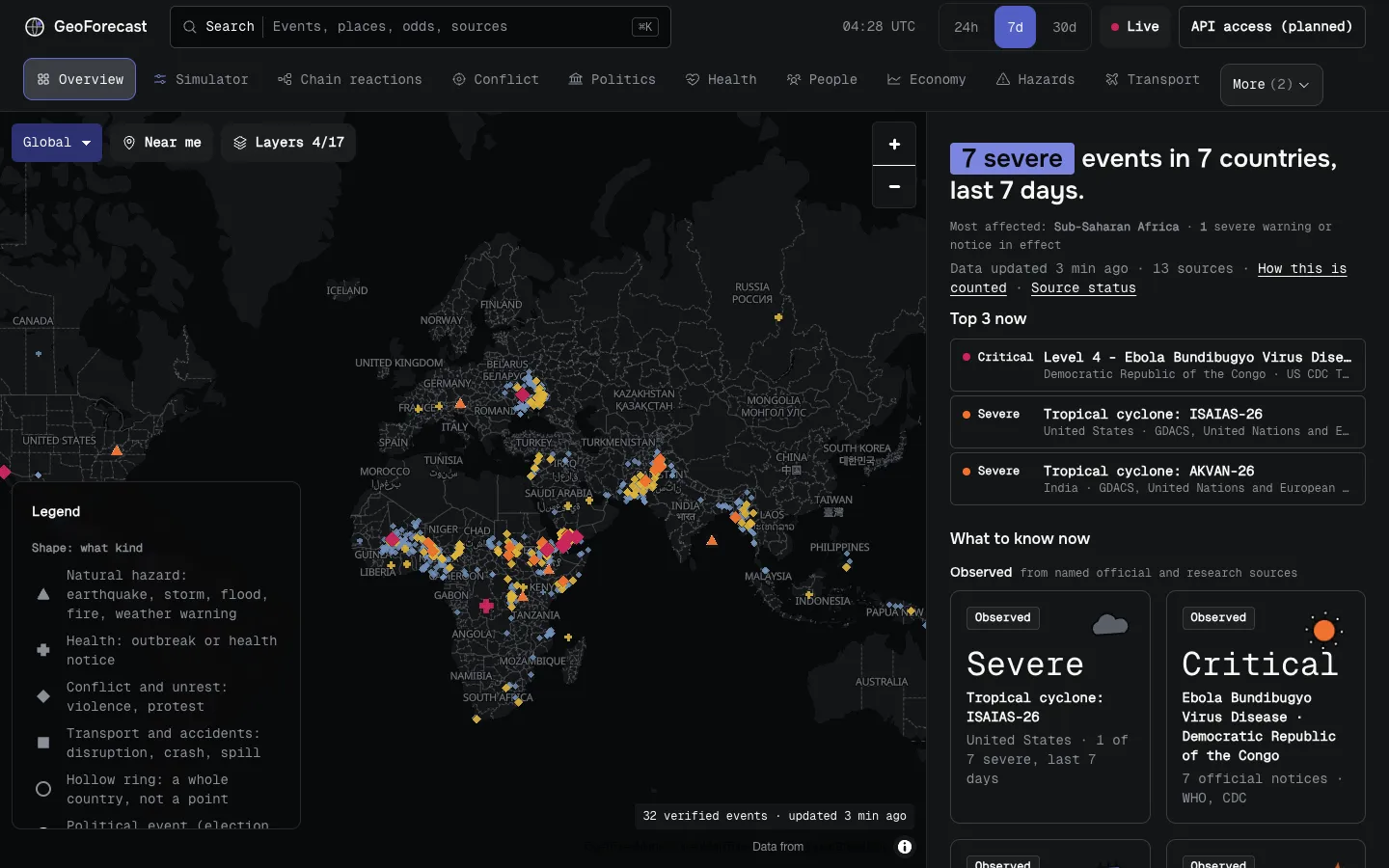
The map and the report beside it
The map shows where. The report beside it says how serious, in plain words, and every item opens to its source, its time and a link to the original. Nine topic views, from Conflict and Health to Transport and AI, work the same way.
How a what-if works
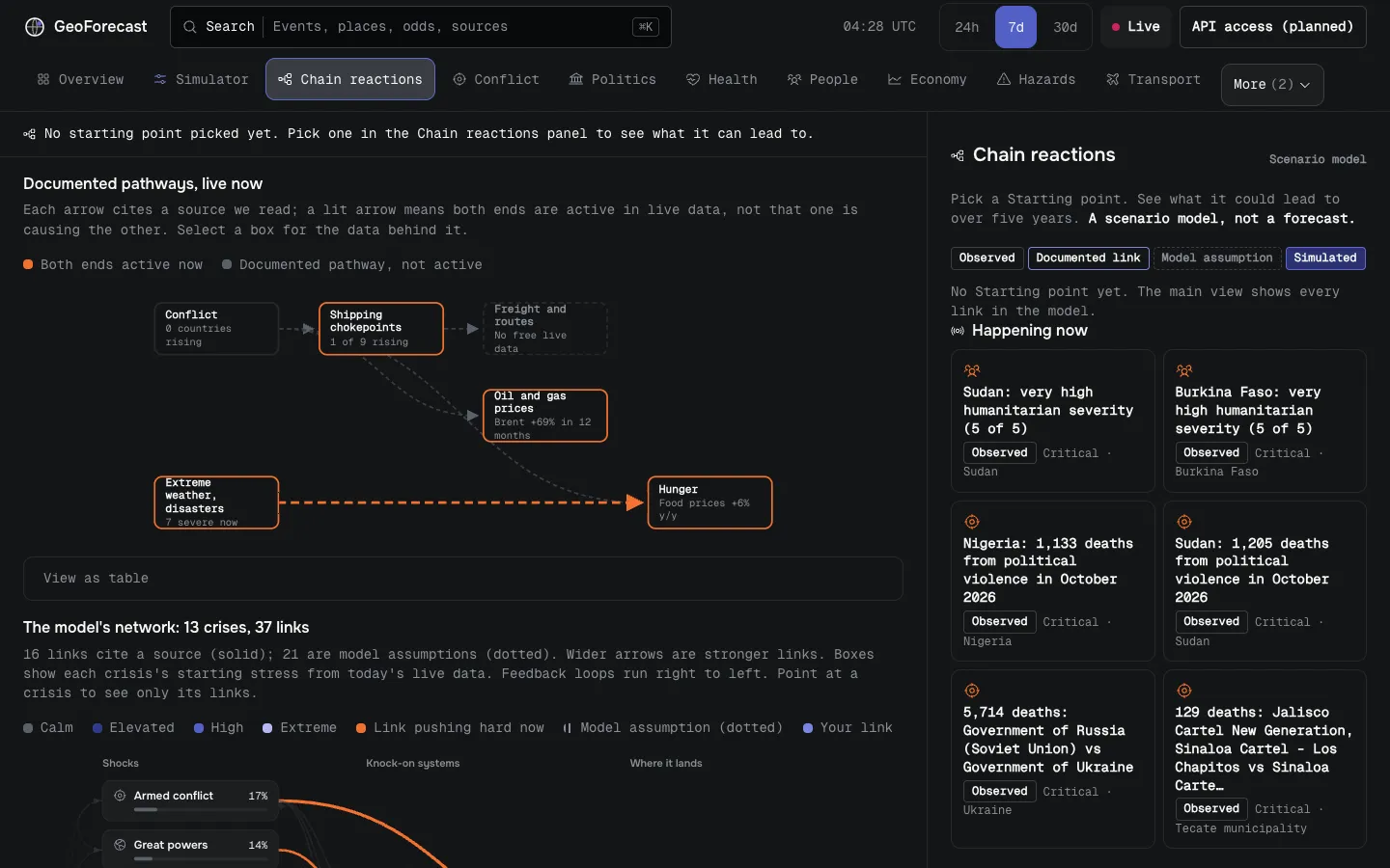
The Simulator is a small, open model of 13 linked crises. You give it a shock and it shows what could follow.
Simulated Scenario model, not a forecast. Numbers are shares of model runs, not the chance that anything happens.
Run this what-ifStart from today
The model reads today’s live data as its starting point.
Add a shock
Pick a live event or a preset, such as “Gulf war closes the Strait of Hormuz”. That one pushes up armed conflict, great-power tension, energy prices and shipping stress.
Run it 120 times
Each run varies every rate a little, so you get a range of outcomes, not a date.
See where it leads
Chain reactions ranks the outcomes by share of runs and names what tips it: the one assumption that best separates one outcome from the next.
Today’s challenge
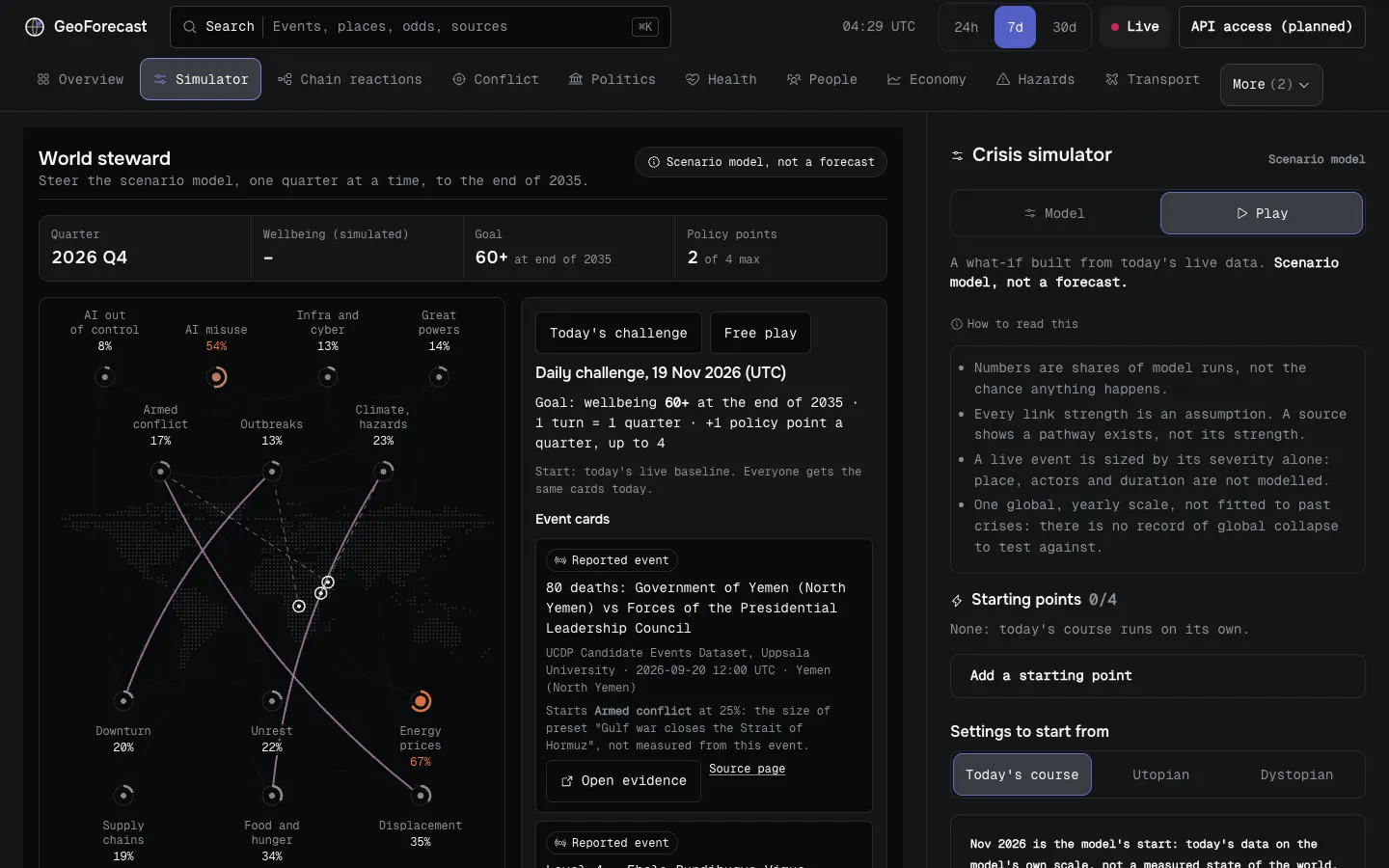
World steward is a short game on the same model. You steer it one quarter at a time to the end of 2035, with a few policy points and event cards dealt from today’s live reports. The goal is wellbeing of 60 or more.
Everyone gets the same cards each day, so you can compare and share a result. It works with a keyboard, and offline after one visit.
Play today’s challengeLabels that say how sure it is
GeoForecast marks what it shows with four labels, so you can tell a report from a guess.
- Observed
- Reported by a named source, with its time and link.
- Documented link
- A source documents that one kind of crisis can lead to another. It does not show that it happened here.
- Model assumption
- A link the model assumes, with no source cited. Treat it as a hypothesis.
- Simulated
- Output of the scenario model from your settings. Not a forecast.
Each source also carries a tier, from official agency down to unverified media monitoring. Prediction-market odds are marked as a market’s, not advice and not GeoForecast’s forecast.
How GeoForecast works
Where the data comes from
GeoForecast reads 21 public data feeds and re-reads most of them every 10 to 30 minutes. Natural hazards come from USGS, GDACS, NASA and national weather services through the WMO. Health comes from WHO Disease Outbreak News and US CDC travel notices. Conflict comes from UCDP at Uppsala University, ACLED totals, ACAPS and the GDELT news monitor. Internet outages come from IODA at Georgia Tech. Other feeds cover transport, politics, AI incidents and headlines.
Every item keeps its source, its time and a link to the original. When a source fails, the page says which part is missing instead of hiding the gap. The full list, with each source’s terms, is on the methodology page.
What it will not do
GeoForecast does not predict. It makes no odds of its own. Where it shows odds, they come from a named real-money prediction market, with the date and the amount traded.
The Simulator and the game are a scenario model: what could follow from assumptions you can read and change. It is not a warning service. For a safety decision, use your national authorities and the original source.
Who it is for
Anyone who wants a calm picture of the world without a stream of alarms. It is also built for people who check a number before they use it: analysts, journalists, and NGO and government readers. Search covers everything you have seen, even offline, and every view has a link you can share.
Works where you are
- Offline and on weak connections
- The app and the last data it saw stay on your device. With no signal, it opens and shows that data with its age.
- Private by default
- No account, and nothing to sign up for. Privacy
- Accessible
- Built to WCAG 2.1 AA. Every chart has a table, colour is never the only signal, and the report, the Simulator and the game work with a keyboard.
API access (planned)
The dashboard is free and will stay free. An API for the same data is planned, not built yet. If you would use it, leave your email and you will hear when it opens. There is no price and nothing to pay.
Questions people ask
Is GeoForecast free?
Yes. The dashboard, the Simulator and the game are free, with no account. API access is planned, and there is no price for it yet.
Does GeoForecast predict wars or disasters?
No. It shows what sources report now. Odds come only from named prediction markets and are labelled as theirs. The Simulator is a scenario model, not a forecast.
Where does the data come from?
From 21 public data feeds, including USGS, GDACS, NASA, WHO, CDC, UCDP, ACLED, ACAPS, IODA and national weather services. Every item links to its source.
How current is it?
Most feeds are re-read every 10 to 30 minutes, and an open page refreshes every 5 minutes. Each item shows its own time.
Does it work offline?
Yes, after one visit. The app and the last data it saw stay on your device, and search works on everything you have seen.
What does GeoForecast collect about me?
There is no account, and your email is stored only if you ask to hear about the API. The privacy page has the details.
Can I use the data in my work?
Cite the original source linked on each item, under that source’s terms, with the time you read it. The methodology page explains how to cite GeoForecast.
Who makes GeoForecast?
Chiranjeet Banerjee, through Blisse Code, his house of design and AI experiments.
Made by Blisse Code
I’m Chiranjeet Banerjee. I make GeoForecast at Blisse Code. If a number here looks wrong, or you want to use GeoForecast in your work, tell me.